

Our Geographic Information Systems (GIS) team plays a unique role at the state level, working to coordinate GIS efforts across Colorado. This involves providing resources, enhancing the availability of geospatial information and fostering relationships with partners around the state. Last December, they completed a project that illustrates how these technical efforts can assist counties that lack dedicated GIS resources in their operations. We are sharing this story now to highlight the long-term success and impact the application has demonstrated over the past year of deployment.
Hinsdale County needed property maps
Self-proclaimed as the most remote area in the US lower 48 states, Hinsdale County is highly mountainous and contains roughly 96.5% of public land, making property information management challenging. Unlike other more connected counties in the state, Hinsdale lacks its own dedicated GIS resource to maintain crucial parcel data that can be accessible to assessors and the public. This made it harder for county officials and the public to easily access property details. OIT's GIS team got the call to help solve this problem.
Developing Solutions
“The adage ‘a picture is worth a thousand words’ could equate in this instance to ‘an online map is worth a thousand words and as many trips to the Assessor’s office.’” Sarah Tubbs, Hinsdale County Deputy Assessor
The OIT team of GIS Analysts was tasked with developing an online map application for Hinsdale County. This process involved identifying the county's specific needs, such as the ability to search for parcels by ID or owner. The team then conducted a thorough exploration. In addition to incorporating the county's parcel data, the team also included Hinsdale-specific information, such as zoning boundaries, historic districts and roads. These layers were essential for overlaying with the parcel data, as requested by the county.
The resulting interactive map displays Hinsdale County parcels and other reference layers, such as structures and roads. A black outline symbolizes parcels and can be clicked on or searched to view more information.
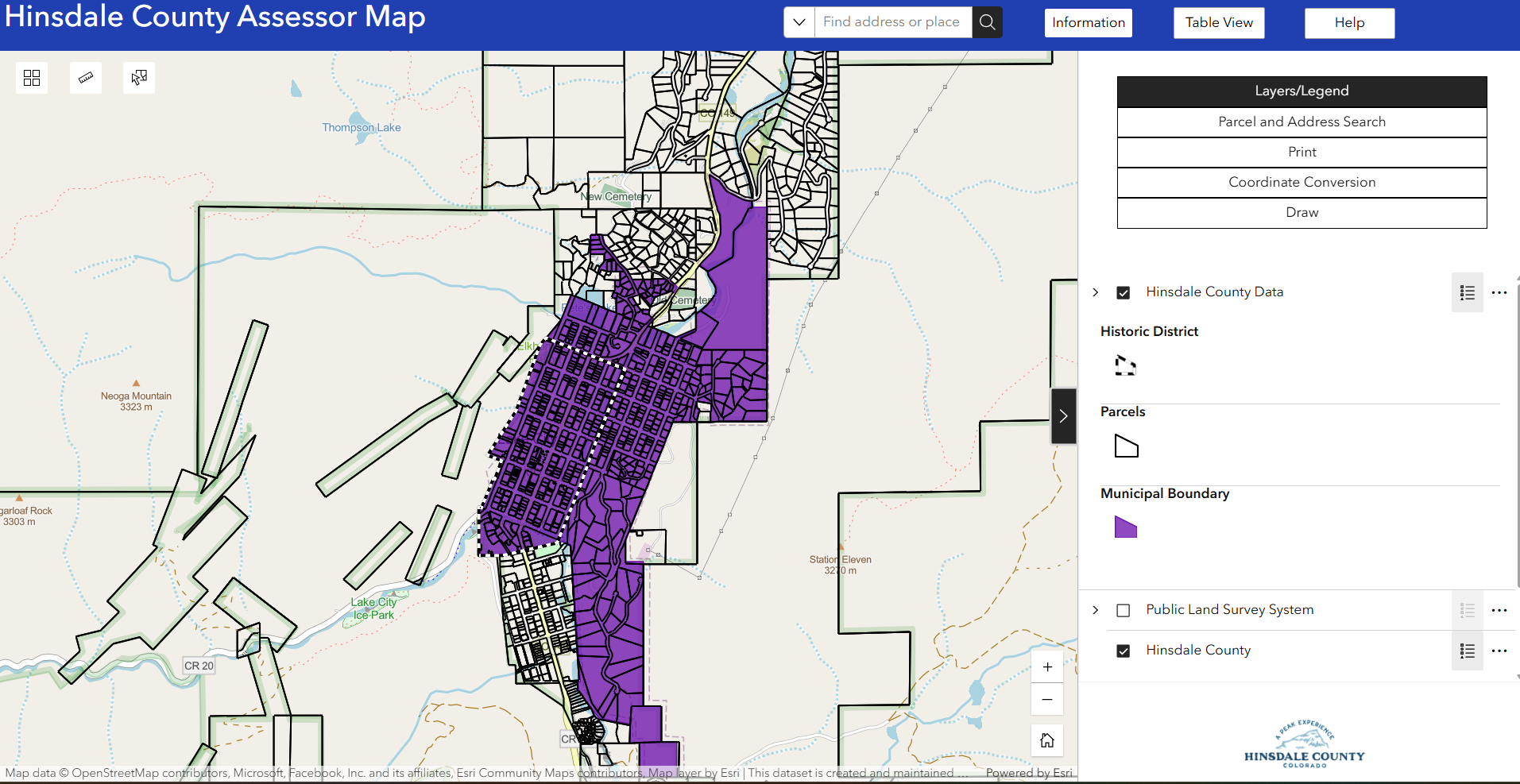
Building the Hinsdale application involved integrating data and resources from several OIT initiatives. Parcel data, provided by Hinsdale County, was incorporated using a standardized structure developed as part of our "Annual Data Call" project. This project aggregates data from nearly every county in Colorado into a unified dataset. Additionally, high-resolution imagery within the application is sourced through our partnership with the Colorado Department of Transportation (CDOT).
A Proven Success: 1,500 Views and Counting
The application aims to provide county assessors and the public with a more accessible way to view properties and access related information.
Since its launch, the Hinsdale parcel application has received overwhelmingly positive feedback. Having been accessed over 1,500 times, Hinsdale County officials reported that the application has been invaluable, stating that it is now used by most of their county departments, including Building, Road and Bridge, Planning Commission and County Commissioners. The app has also proven highly useful to the public, including property owners, real estate agents and outdoor recreationists. The ease of access has benefited property taxpayers by allowing easier access to their data, which has, in turn, increased communication with the Assessor's office and helped to keep property record data up to date and more accurate. One official summarized the impact: "With our county’s minimal tax base, we would still be fighting to have a web-based application like this funded and executed, if not for OIT."
This project for Hinsdale County highlights how OIT's technical capabilities, including our statewide GIS coordination efforts, can improve data accessibility and operational efficiency for Coloradans regardless of their location in the state.
Ready to improve your data capabilities? Discover upcoming events, trainings and available tools on the GIS Events page.